

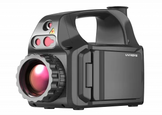
Description
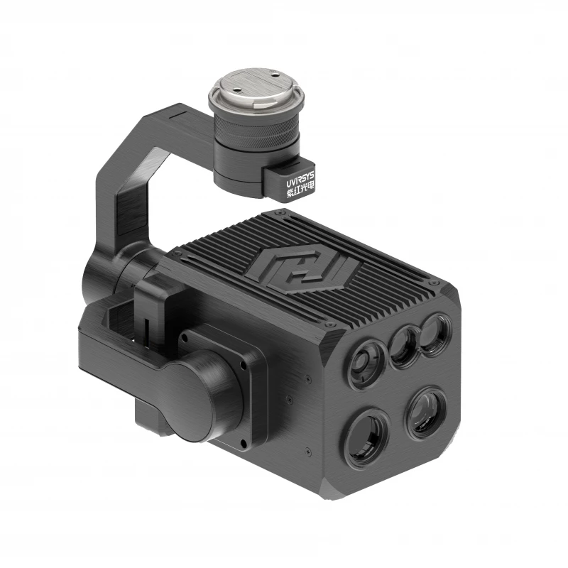
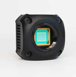
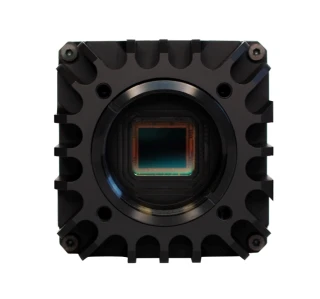
**Visualizing Discharge Viewing Temperature with UVIRSYS** The ZH580-UAV-S is a cutting-edge multi-spectral imaging system designed to revolutionize the way we visualize discharge and monitor temperature anomalies. This advanced system is integrated with ultraviolet (UV), infrared (IR), visible light, and laser technologies, offering a comprehensive solution for precise diagnostics. Its lightweight and compact design make it an ideal choice for drone applications, ensuring quick deployment and efficient operation in various environments.
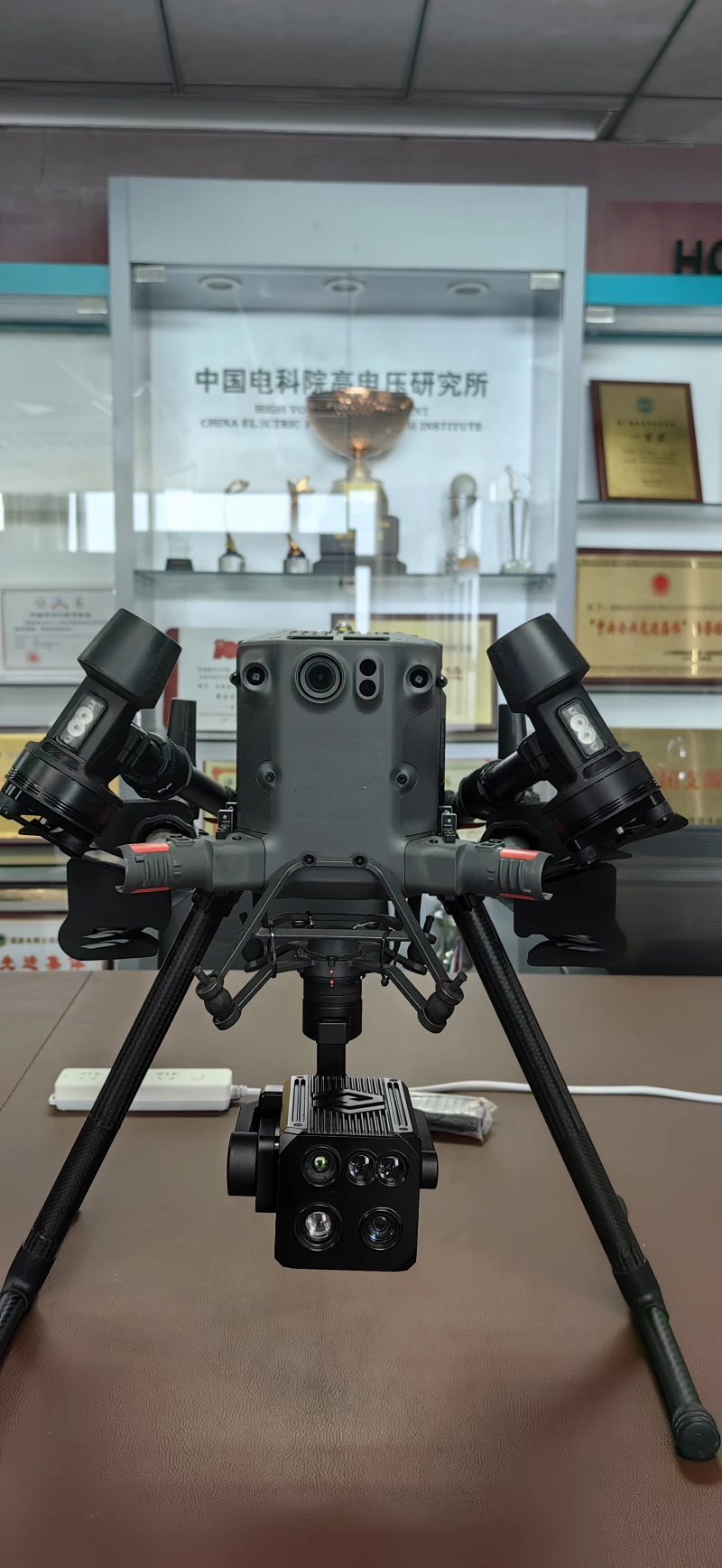
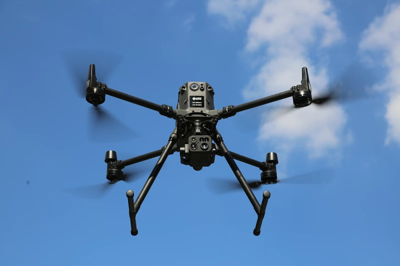
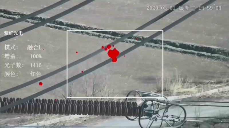
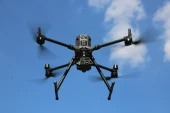
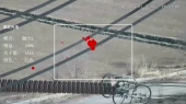
Developed on the PSDK platform, the ZH580-UAV-S seamlessly integrates with mainstream drones like the M300RTK. This integration allows for high-precision image registration, enabling the system to accurately detect and locate corona discharges, temperature anomalies, and other defects. The fusion of images from multiple spectral channels enhances diagnostic accuracy, reduces false alarms, and improves detection efficiency. The ZH580-UAV-S is particularly well-suited for industries such as power transmission and distribution, railway line monitoring, substation inspections, and forest fire prevention. Its robust design ensures excellent shock resistance and stability, making it reliable even in challenging conditions.
With its advanced multi-spectral imaging capabilities, the ZH580-UAV-S sets a new standard in aerial inspection and monitoring, providing unparalleled insights into the health and safety of critical infrastructure.
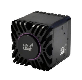
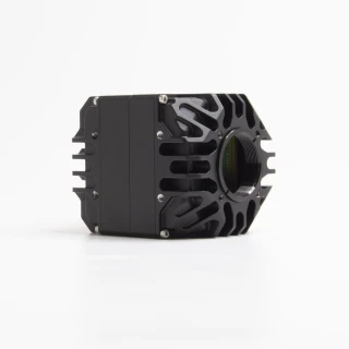
ZH580-UAV-S 3-in-1 Camera for Drones UV+IR+VIS
Specifications
| Camera Type: | Industrial |
|---|---|
| Array Type: | Vanadium Oxide (VOx) Microbolometer |
| Spectral Band: | 0.24 – 14 um |
| # Pixels (Height): | 720 |
| # Pixels (Width): | 1280 |
| Pixel Pitch: | 12 um |
| Array Cooling: | Uncooled |
| UV Wavelength Range: | 240~280 nm |
| Discharge Sensitivity: | 1Pc @10 m |
| RIV Sensitivity: | 3.6 dBμV(RIV) @ 1 MHz@10 m |
| UV Sensitivity: | 2.0×10^-18 watt/cm^2 |
| Focus: | Auto focus 1.5m- ∞ |
| Sensitivity: | 0.1 Lux |
| Optical Zoom: | 28x |
| Digital Zoom: | 12x |
| Overlay Accuracy: | ≤ 1mrad |
| IR Wavelength Band: | 8-14µm |
| Temperature Range: | -20 ℃— +400 ℃ |
| Temperature Accuracy: | ±2 ℃ /±2 % |
| Dimensions (Main Unit): | 141×144×127 mm |
| Weight (Main Unit): | 1.5 kg |
| Protection Level: | IP54 |
| Drone Dimensions (Unfolded): | 810×670×430 mm |
| Drone Dimensions (Folded): | 430×420×430 mm |
| Flight Altitude: | 5000 m |
| Wind Resistance: | 15 m/s |
| Flight Time: | 55 min |
Got questions about specs? Use the inquiry form to ask.
Features
- 4-in-1 Multi-Spectral Integration: Combines UV, IR, VIS, and laser ranging in one compact system.
- High Sensitivity Detection: Detects corona discharges, temperature anomalies, and structural defects with precision.
- Advanced Pan-Tilt System: Excellent shock resistance, fast docking, and stable aerial operation.
- Lightweight & Portable: Weighs only 900 g with pan-tilt for easy UAV integration.
- High Imaging Accuracy: Fused multi-spectral imaging with ≤1 mrad overlay precision.
- Flexible Display Modes: Supports UV, IR, VIS, and combined imaging options for diagnosis.
- Durable Design: IP54-rated protection ensures reliable performance in harsh environments.
- Comprehensive Data Capture: Supports photo/video formats, temperature alarms, GPS data, and real-time UAV control.
Applications
- Power Transmission & Distribution Lines: Detect corona discharges and hot spots for predictive maintenance.
- Railway Inspection: Identify equipment anomalies to ensure safe and efficient railway operations.
- Substation Monitoring: Enhance detection of temperature and discharge issues in high-voltage equipment.
- Forest Fire Prevention: Monitor hotspots and early fire indicators using IR and VIS fusion imaging.
- UAV-Based Maintenance Services: Expand operational efficiency for aerial asset monitoring across industries.
Frequently Asked Questions
What is the ZH580-UAV-S?
What are the key features of the ZH580-UAV-S?
What is the purpose of the multi-spectral joint diagnosis?
What are the specifications of the UV channel?
What imaging modes are supported by the ZH580-UAV-S?
What are the physical characteristics of the ZH580-UAV-S?
What are the drone specifications when equipped with the ZH580-UAV-S?
Got more questions? Use the RFQ form to ask the supplier directly.
Similar Products


Need pricing for this product? Send a quick inquiry
Your inquiry has been received.
Create an account by adding a password
Why create an account?
- Auto-complete inquiry forms
- View and manage all your past messages
- Save products to your favorites
- Close your account anytime — no hassle