FILTER PRODUCTS

Select a category above to apply technical filters

Laser Scanning and Ranging Solutions

1.54 µm Eye-safe long distance laser rangefinder transceiver/module based on diode pumped monoblock microchip  Er^3+, Yb^3+:Phosphate glass monolithic laser cavity transmitter with compact design and light weight assure OEM integration easy. One series of such transceivers are commercially available upon request for OEM ...

Specifications

Measurement Range: 500-10000000mm
Resolution : 500 mm
Ranging Capability (2.3m×2.3m Target): ≥10 km
Wavelength: 1535 nm
Divergence: ≤0.3 mrad
...
Data Sheet
LSP-LRE-4020A Remote Laser Rangefinder Module is developed based on a 1570nm OPO laser, the wavelength is far away from the working band of laser weapons, which is of great significance in the field of special applications. The product adopts a single pulse time-of-flight ranging method, which can reach 40km for large aircraft ...

Specifications

Maximum Measurement Range: 40000 m
Minimum Measurement Range: 50 m
Measurement Rate: 1 meas./sec
Accuracy: 500 mm
Precision: 500 mm
...
Data Sheet
The RIEGL miniVUX-3UAV is an extremely lightweight airborne laser scanner, designed specifically for integration with UAS/UAV/RPAS. The sensor offers a selectable 100 kHz, 200 kHz, and 300 kHz laser pulse repetition rate (PRR). With 300 kHz PRR, it provides up to 100,000 measurements per second at 120° FoV and thus a ...

Specifications

Maximum Measurement Range: 170 m
Minimum Measurement Range: 2 m
Measurement Rate: 200,000 meas./sec
Accuracy: 15 mm
Precision: 10 mm
Data Sheet
he VQ-1560 II-S follows the successful concept of RIEGL’s proven dual channel laser scanner series. With increased laser power the operational altitudes are extended up to 1700m AGL at a pulse repetition rate of 4MHz, or up to 3900m AGL at a pulse repetition rate of 540kHz (all values given for 20% target reflectance). ...

Specifications

Maximum Measurement Range: 4,800 m
Minimum Measurement Range: 100 m
Measurement Rate: 2.66 mill meas./sec
Accuracy: 20 mm
Precision: 20 mm
Data Sheet
The RIEGL VQX-1 is a compact, rugged, and aerodynamically shaped wing pod, designed for user-friendly installation and to facilitate various airborne mapping applications. The pod is designed to carry one RIEGL Laser Scanner (VQ-480 II, VQ-580 II-(S), VUX-240, VUX-120-23, VUX-160-23 or VQ-840-G /-GL) as ...

Specifications

Maximum Measurement Range: depending on scanner m
Minimum Measurement Range: depending on scanner m
Measurement Rate: depending on scanner meas./sec
Accuracy: depending on scanner mm
Precision: depending on scanner mm
Data Sheet
The VQ-1460 is one of RIEGL‘s latest high-end airborne laser scanning systems, suitable for a wide field of applications – from high-point density wide area mapping to ultra-high resolution city mapping or corridor mapping. The unique design features pulse repetition rates from 4.4 MHz, resulting in a regular point ...

Specifications

Maximum Measurement Range: 5,400 | 5,400 m
Minimum Measurement Range: 100 | 100 m
Measurement Rate: 2,935,000 | 1,468,000 meas./sec
Accuracy: 20 | 20 mm
Precision: 20 | 20 mm
Data Sheet
The VQ-680 is a compact airborne laser scanner optimized for urban mapping, forestry and power line survey applications – or wherever high-precision, high-accuracy surveying of complex environments are required. The scanner’s vertical design and small aperture dimensions enable a compact integration with digital cameras ...

Specifications

Maximum Measurement Range: 4450 m
Minimum Measurement Range: 20 m
Measurement Rate: 2,000,000 meas./sec
Accuracy: 20 mm
Precision: 20 mm
Data Sheet
RIEGL VUX-160²³ The new RIEGL VUX-160²³ is a lightweight and versatile airborne laser scanner offering a wide field of view of 100 degrees and an extremely high pulse repetition rate of up to 2.4 MHz. Thus, it is perfectly suited for high point density corridor mapping applications.The measuring beam of ...

Specifications

Maximum Measurement Range: 980 | 760 m
Minimum Measurement Range: 5 | 5 m
Measurement Rate: 2,000,000 | 2,000,000 meas./sec
Accuracy: 10 | 10 mm
Precision: 5 | 5 mm
Data Sheet
The new RIEGL VQ-840-GL is a fully integrated, compact airborne  laser scanner for combined topographic and bathymetric  surveying. The LiDAR system is now offered in a new design. Maintaining the proven form factor, the internal redesign and use of  very lightweight material enables a reduced weight of less ...

Specifications

Maximum Measurement Range: - m
Minimum Measurement Range: 20 m
Measurement Rate: - meas./sec
Accuracy: 20 mm
Precision: 15 mm
...
Data Sheet
The RIEGL VMX-2HA is a High Speed, High  Performance Dual Scanner Mobile  Mapping System which provides dense, accurate, and feature-rich data at highway speeds. With 3.6 million measurements and  500 scan lines per second, this turn-key  solution is ideally suited for  survey-grade mobile ...

Specifications

Maximum Measurement Range: 475 m
Minimum Measurement Range: 1 m
Measurement Rate: - meas./sec
Accuracy: 5 mm
Precision: 3 mm
Data Sheet
The RIEGL VMY-1 is an extremely compact, economically priced Mapping System of small dimensions, that is well suited for a variety of basic mobile mapping applications. The central part of the system is the RIEGL miniVUX-HA LiDAR sensor providing 125 scan lines / second and up to 300 kHz Pulse Repetion Rate.The ...

Specifications

Maximum Measurement Range: 270 m
Minimum Measurement Range: 1 m
Measurement Rate: - meas./sec
Accuracy: 10 mm
Precision: 10 mm
...
Data Sheet
The RIEGL VZ-600i offers a broad range capability from 0.5 m up to 1000 m and is suitable for indoor and outdoor 3D mapping applications. 3D position accuracy of 3 mm, less than 30 sec scan time for high-resolution scans with 6 mm point spacing at 10 m, enabling more than 60 scan positions/hour with real-time registration, ...

Specifications

Maximum Measurement Range: 220 m
Minimum Measurement Range: 100 m
Measurement Rate: - meas./sec
Accuracy: 5 mm
Precision: 3 mm
...
Data Sheet
LumiSpot's L1535 Rangefinder Module Series: Redefining Precision with Advanced Laser Rangefinder ModulesEmbark on a journey to the forefront of laser measurement technology with LumiSpot's L1535 LRF Module Series. These state-of-the-art Rangefinder Modules are a testament to our commitment to innovation, safety, and ...

Specifications

Maximum Measurement Range: 12000 m
Minimum Measurement Range: 50 m
Measurement Rate: -- meas./sec
Accuracy: 2000 mm
Precision: -- mm
...
Data Sheet
3km LRF Ranging Module for Laser Distance MeasurementThe Lumispot Tech LSP-LRS-0310F is a compact and lightweight laser rangefinder module, notable for being the smallest of its kind, weighing only 33g. It is a highly precise tool for measuring distances up to 3km, tailored for photoelectric systems where accuracy and reliability are ...

Specifications

Maximum Measurement Range: 3000 m
Minimum Measurement Range: 20 m
Measurement Rate: 10 meas./sec
Accuracy: -- mm
Precision: 3000 mm
...
Data Sheet
Introducing Lumispot Tech's Human Eye Safety Laser Ranging Module, a cutting-edge solution for precise distance measurement. Powered by our 1535nm laser technology, this module prioritizes safety, accuracy, and reliability. Safety is paramount, with first-class human eye safety classification, suitable for various ...

Specifications

Maximum Measurement Range: 6000 m
Minimum Measurement Range: 30 m
Measurement Rate: -- meas./sec
Accuracy: 2000 mm
Precision: -- mm
...
Data Sheet
IDIL Fibres Optiques developed the first industrial Photonic Doppler Velocimeter for shocks and detonic applications. This technology allows to measure unique or multiple speeds, in the range of 0 to 20 km/s with an excellent temporal resolution. A dedicated software, based on a Fourier Transform algorithm, allows a rapid ...

Specifications

Displacement Interferometer: High dynamics (>27 dB)
Eye Safety: (1.55 μm) all fibered design μm
Minimum Reflectance Required: -60 dB dB
Speed Measurement: 0 to 20 km/s km/s
High Sensitivity: >50 dB dB
...
Data Sheet
The laser range finder for mil standard, measurement range up to 40km.

Specifications

Maximum Measurement Range: 6000 m
Minimum Measurement Range: 2 m
Measurement Rate: 1Hz meas./sec
Accuracy: 2000 mm
Precision: 2000 mm
Data Sheet
Gas Mapping LiDAR
Bridger Photonics Inc
The oil & gas industry is under tremendous pressure to reduce methane emissions. This pressure has put the industry in an untenable position, as no viable technology has existed to image and quantify this invisible gas in a reliable, sensitive, and cost-effective manner—until now. Bridger Photonics’ Gas Mapping LiDAR™ makes it ...

Specifications

Laser Wavelength: -- nm
Scanning Angle: -- deg
Scanning Frequency Range: 1-1Hz
Angular Resolution: -- deg
Measurement Range: 1-10m
...
Data Sheet
Standard Lidar Scanners And Electro-Optical-Mechanical Systems
DFM Engineering Inc
DFM Engineering is a leading supplier of custom system components to the companies that are defining the parameters and creating new uses for LIDAR technology. With experience in custom-designing and building high quality, research-gradetelescopes since 1978, we deliver the proven components you need for a competitive ...

Specifications

Laser Wavelength: -- nm
Scanning Angle: 60 deg
Scanning Frequency Range: 1-10Hz
Angular Resolution: 60 deg
Measurement Range: 1-1m
...
Data Sheet
Custom Lidar Scanners
DFM Engineering Inc
DFM Engineering has provided many Electro-Optical-Mechanical (EMOS™) scanner systems used for Light Detection And Ranging (LIDAR) remote sensing applications. Typically these scanners are an Alt-Az Coude\' form of a beam director using two flat mirrors. The major difference between a LIDAR scanner and a beam director is the ...

Specifications

Laser Wavelength: -- nm
Scanning Angle: 120 deg
Scanning Frequency Range: 1-10Hz
Angular Resolution: 60 deg
Measurement Range: 1-10m
...
Data Sheet
Direct Diode - Low Beam
Lasertel
3kW Peak Power in 5nsec Pulses.

Specifications

Laser Wavelength: 760-1700 nm
Scanning Angle: 60 deg
Scanning Frequency Range: 1-1Hz
Angular Resolution: 20 deg
Measurement Range: 1-1m
...
Data Sheet
Direct Diode - High Beam
Lasertel
10kW Peak Power in 20nsec Pulses.  

Specifications

Laser Wavelength: 760-1700 nm
Scanning Angle: 60 deg
Scanning Frequency Range: 1-1Hz
Angular Resolution: 20 deg
Measurement Range: 1-1m
...
Data Sheet
LDM 150 LASER TAPE LASER DISTANCE MEASUREMENT TOOL
Laser Tools Co Inc
One button operation gives you long distance readings between two points that are accurate to 1/16 of an inch. This means that you can use the LDM 150 just like a tape measure for inside dimensioning. Calculate: LengthAreaVolumeHeightIncludes Pythagorean’s TheoremThis means that you can calculate lengths that are hard to reach ...

Specifications

Measurement Range: 1-60000mm
Resolution : -- mm
Data Sheet
DP-ELRF II DIODE-PUMPED EYE-SAFE LASER RANGE FINDER
L-3 Advanced Laser Systems Technology
The Diode-Pumped Eye-Safe Laser Range Finder (DP-ELRF) II is a Class 1 eye-safe, long-range laser range finder with improvements that extend capabilities beyond L3Harris’s legacy flash-lamp product line. Improvements to laser beam divergence, laser boresight retention, system shotlife and receiver sensitivity result in superior ...

Specifications

Maximum Measurement Range: 20000 m
Minimum Measurement Range: 50 m
Measurement Rate: -- meas./sec
Accuracy: 5000 mm
Precision: 1000 mm
Data Sheet
DP-ELRF - MLRF-2B LASER RANGE FINDER
L-3 Advanced Laser Systems Technology
The Miniature Laser Range Finder (MLRF)-2B is the latest addition to the L3Harris Diode-Pumped Eye-Safe Laser Range Finder product family. Weighing just over 1kg, firing with nominal 3 mJ output energy, optimized beam divergence, an integrated visible Boresight source, and sensitive APD receiver, the MLRF-2B provides even the most ...

Specifications

Maximum Measurement Range: 25000 m
Minimum Measurement Range: 50 m
Measurement Rate: -- meas./sec
Accuracy: 5000 mm
Precision: 1000 mm
Data Sheet

Frequently Asked Questions

LiDAR (Light Detection and Ranging) technology uses laser light to measure distances and create 3D models of objects and environments. A LiDAR device emits a laser beam and measures the time it takes for the beam to bounce back from objects in its path. By collecting and analyzing this data, LiDAR devices can create highly accurate 3D models of objects and environments.

The main advantages of using LiDAR technology include high accuracy, speed, and the ability to capture detailed 3D data of objects and environments. LiDAR technology is widely used in various industries, including surveying, mapping, environmental monitoring, and autonomous vehicles.

A laser scanner is a device that uses laser technology to measure distances and create 3D models of objects and environments. While LiDAR also uses laser technology, it typically refers to devices that use a scanning laser beam to generate 3D data. Laser scanners, on the other hand, use a fixed laser beam that scans across an object or environment to capture 3D data.
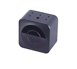
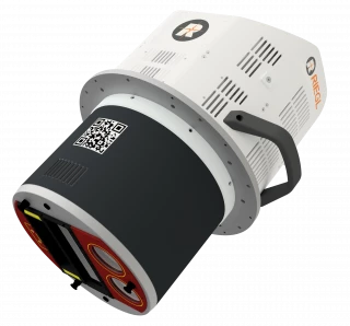
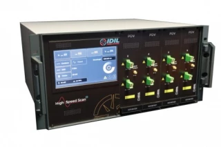
Laser scanning and ranging technology is commonly used in a variety of industries, including surveying, mapping, environmental monitoring, and construction. It can be used to create detailed 3D

2D laser scanning captures data along a single plane, creating a 2D image. 3D laser scanning captures data along multiple planes to create a 3D image. 3D laser scanning is typically more accurate and detailed than 2D laser scanning.
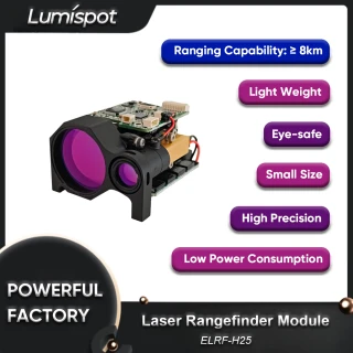
The range of laser scanning and ranging devices can vary widely depending on the device and its intended use. Some devices are capable of measuring distances up to several hundred meters, while others are designed for short-range scanning and imaging.

A variety of lasers can be used in laser scanning and ranging devices, including diode lasers, fiber lasers, and solid-state lasers. The type of laser used will depend on the specific application and requirements of the device.

The accuracy of laser scanning and ranging devices can vary widely depending on the device and its intended use. High-end devices are capable of sub-millimeter accuracy, while lower-end devices may have accuracy in the range of several millimeters.

The Laser Scanning and Ranging Solutions category on FindLight.net offers a comprehensive range of LiDAR and laser scanning solutions from top manufacturers in the industry. These products are essential for a wide range of applications, including environmental monitoring, surveying, mapping, and more. With our selection of 2D and 3D scanning products, distance measurement tools, and high-resolution imaging solutions, you can find the right product for your needs.

Did You know?

Did you know that laser scanning and ranging technology is revolutionizing the way we collect and analyze data in various industries? By using advanced laser and light-based imaging technologies, these products can generate detailed 3D models of objects and environments with high accuracy and precision. Applications of laser scanning and ranging technology range from forestry management, to infrastructure and construction monitoring, to archaeology, to autonomous vehicle navigation. FindLight's Laser Scanning and Ranging category features a wide range of products from top manufacturers in the industry, including LiDAR sensors, laser scanners, and more.