
Description
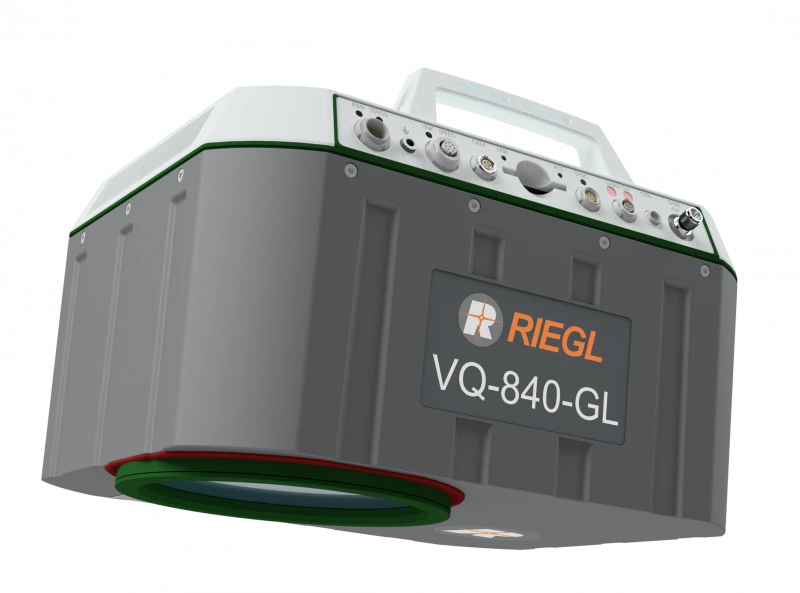
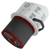
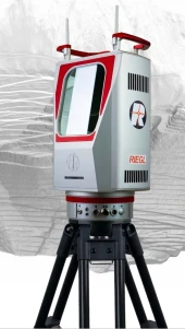
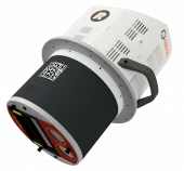
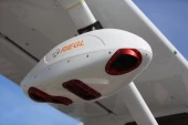
The new RIEGL VQ-840-GL is a fully integrated, compact airborne laser scanner for combined topographic and bathymetric surveying. The proven form factor and the use of very lightweight material make the VQ-840-GL suitable for integration into crewed aircraft and UAVs. VQ-840-GL offers customer specific initial system configurations and a large choice of parameter settings to enable mission tailored operation.
The scanner carries out laser range measurements for high resolution surveying of underwater topography with a narrow, visible green laser beam, emitted from a pulsed laser source. Subject to clarity, at this particular wavelength the laser beam penetrates water enabling measurement of submerged targets.
The distance measurement is based on the time-of-flight measurement with very short laser pulses and subsequent echo digitization and online waveform processing. To handle target situations with most complex multiple echo signals, beside the online waveform processing the digitized echo waveforms can be stored for subsequent off-line full waveform analysis.
The laser beam is deflected in an elliptic scan pattern and hits the water surface at an incidence angle with low variation.
The VQ-840-GL can be complemented with an inertial navigation sensor for subsequent estimation of the instrument’s location and orientation. As a further option a high-resolution digital camera can be integrated. The rugged internal mechanical structure together with the dust- and splash water proof housing enables long-term operation on airborne platforms.
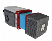
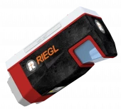
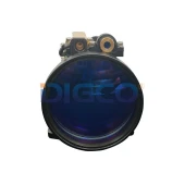
RIEGL VQ-840-GL
Specifications
| Maximum Measurement Range: | Not Specified |
|---|---|
| Minimum Measurement Range: | 20 m |
| Measurement Rate: | Not Specified |
| Accuracy: | 20 mm |
| Precision: | 15 mm |
| Laser Wavelength: | 532 (green) nm |
| Weight: | 9.8 kg |
Features
- designed for combined topographic and bathymetric airborne and UAV-based survey
- high accuracy ranging based on echo digitization and online wave-form processing with multiple-target capability
- concurrent comprehensive full waveform storage for all measurements for subsequent full waveform analysis and waveform averaging tasks
- high spatial resolution due to measurement rate of up to 200 kHz and high scanning speed of up to 100 scans/sec
- integrated inertial navigation system (optional)
- integrated digital camera (optional)
- compact, lightweight and robust housing compliant with typical hatches in aircrafts and with stabilized platforms
Applications
- Coastline and Shallow Water Mapping
- Surveying for Hydraulic Engineering
- Hydro-Archaeological-Surveying
- River Surveying
- Repeated Survey of Water Reservoirs
Frequently Asked Questions
What is the RIEGL VQ-840-GL?
How much does the RIEGL VQ-840-GL weigh?
What is the laser beam used for in the RIEGL VQ-840-GL?
Can the RIEGL VQ-840-GL handle complex multiple echo signals?
What are some applications of the RIEGL VQ-840-GL?
Similar Products
Your inquiry has been received.
Create an account by adding a password
Why create an account?
- Auto-complete inquiry forms
- View and manage all your past messages
- Save products to your favorites
- Close your account anytime — no hassle