Description
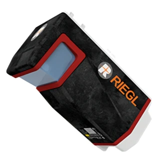
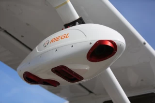
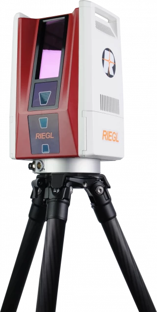
The VQ-1560 III-S is the latest successor in the proven RIEGL dual channel laser scanning system series, suitable for a wide field of applications in airborne mapping.
The well-established “cross-fire” scan pattern enables a forward and backward view to the edges of the swath and a nadir view in the middle of the swath resulting in best point distribution for optimum target sampling. High pulse repetition rates of up to 4.4 MHz allow for operational flying altitudes of up to 1,600 m AGL, or up to 3,900 m AGL at a pulse repetition rate of 560 kHz (all values given for 20% target reflectance).
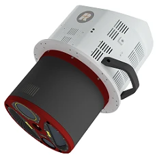
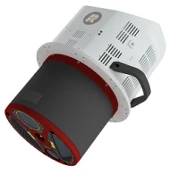
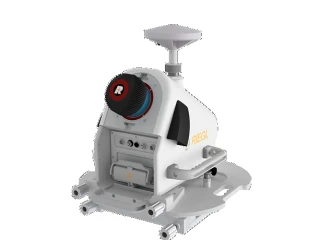
A high-performance IMU/GNSS unit and one or two optional high resolution RGB/NIR cameras are seamlessly integrated in the compact and user-friendly designed housing.
The excellent scan pattern and its wide operational range make the instrument one of the most versatile airborne laser scanners on the market today. It is perfectly suited for any kind of application; from ultra-dense corridor mapping from low altitudes, over high-resolution city mapping with minimum shadowing effects in narrow street canyons, to large-scale wide area mapping at utmost efficiency of up to 1,130 km² per hour at a density of 4 points per square meter.
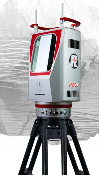
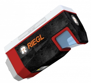
RIEGL VQ-1560III-S Dual Channel Airborne Laser Scanning System
Specifications
| Maximum Measurement Range: | 1600 m |
|---|---|
| Minimum Measurement Range: | 100 m |
| Measurement Rate: | 2930000 meas./sec |
| Accuracy: | 20 mm |
| Precision: | 20 mm |
| Laser Pulse Repetition Rate: | Up to 4.4 MHz |
| Data Storage: | Removable hard disks |
| IMU/GNSS Integration: | High-performance integrated unit |
| Camera Options: | RGB/NIR cameras (optional) |
| Operational Range: | Wide altitudes and densities |
| Mapping Efficiency: | Up to 1,130 km²/hour at 4 points/m² |
| Point Density: | Ultra high-resolution capability |
| Environmental Use: | Optimized for various terrain and weather conditions |
| Field Of View: | 100° |
| Laser Class: | Class 1 (eye-safe operation) |
| Weight: | 2.65 kg |
| Dimensions: | 225x180x125 mm |
| Power Supply: | 28 V DC, 65 W |
| Operating Temperature: | -20 to +50 °C |
| Software: | RiACQUIRE, RIEGL’s proprietary suite |
| Ntegration Options: | Compatible with UAVs, manned aircraft |
Got questions about specs? Use the inquiry form to ask.
Features
- high pulse repetition rates of up to 4.4 MHz
- up to 2.93 million measurements per second on the ground
- best point distribution for optimum target sampling
- atmospheric clutter suppression
- multiple target capability
- online waveform processing and full waveform data recording
- increased sample block lengths
- on-board graphical user interface for easy access to primary scanner parameters
- integrated inertial measurement unit and GNSS receiver
- prepared for the integration of up to two high resolution RGB/NIR cameras
- optimized for interfacing with typical hatches and stabilized platforms
- detachable handgrips for facilitated handling
Applications
- Ultra Wide Area / High Altitude Mapping
- Ultra-High Point Density Mapping
- Mapping of Complex Urban Environments
- Glacier & Snowfield Mapping
- Mapping of Lakesides & River Banks
- Agriculture & Forestry
- Corridor Mapping
Frequently Asked Questions
What is the maximum flying altitude for the RIEGL VQ-1560III-S?
What is the purpose of the "crossfire" scan pattern?
How can the pulse repetition rate be adjusted?
What are the main applications of the VQ-1560III-S?
Does the RIEGL VQ-1560III-S include cameras?
How is the data from the RIEGL VQ-1560III-S stored?
Can the RIEGL VQ-1560III-S be mounted on different aircraft?
What is the maximum mapping efficiency of the VQ-1560III-S?
How does the VQ-1560III-S handle different target reflectances?
What type of data processing capabilities are included?
Got more questions? Use the RFQ form to ask the supplier directly.
Similar Products
Need pricing for this product? Send a quick inquiry
Your inquiry has been received.
Create an account by adding a password
Why create an account?
- Auto-complete inquiry forms
- View and manage all your past messages
- Save products to your favorites
- Close your account anytime — no hassle